
Geological Regions and Geology
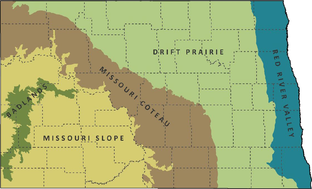
Major Ecoregions of North Dakota.
North Dakota spans from longitude 97°W to 104°W and latitude 45°55'N to 49°N, making it the 19th largest state in the United States.
It stretches 211 miles from north to south and 340 miles from east to west, covering a total of 70,699 square miles.
The state is bordered by Minnesota to the east, Montana to the west, South Dakota to the south, and the Canadian provinces of Manitoba and Saskatchewan to the north.
North Dakota’s highest point is White Butte in the southwestern part of the state, standing at 3,506 feet above sea level, while its lowest point, at 750 feet above sea level, is in the extreme northeast.
Missouri Coteau
The Missouri Coteau extends eastward from the Missouri River to the western boundary of the Drift Prairie, marking the western edge of North Dakota's glaciated terrain.
Wetlands are abundant along the eastern edge of the Coteau but become fewer towards the Missouri River.
The predominant land use in this region is a mix of small grain, corn, soybean, and sunflower farming, along with livestock ranching.
Missouri Slope
The Missouri Slope's sandstone and shale layers were mostly untouched by the glaciers that shaped eastern North Dakota.
The area features an irregular topography, with occasional buttes rising above the landscape.
Complex drainage systems create breaks in the terrain.
Livestock ranching dominates the region, although small grain, corn and sunflower farming is also practiced.
Badlands
North Dakota’s Badlands consist of a rugged landscape of buttes, rock outcrops, washouts, and hardwood draws along the banks of the Little Missouri River.
The region is defined by poor soils, steep slopes, high erosion, and shortgrass prairie.