Where to Hunt
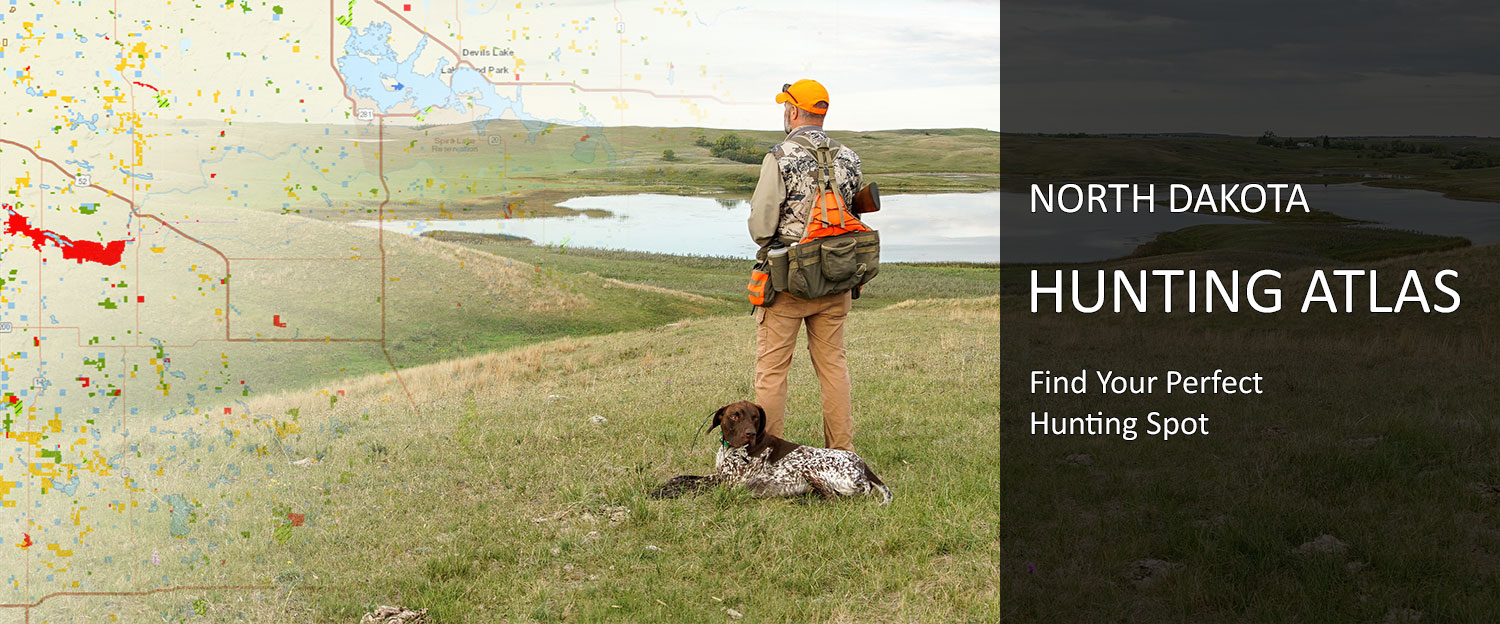
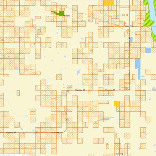
North Dakota Hunting Atlas
Electronically posted lands, WMAs, PLOTS, public lands and more
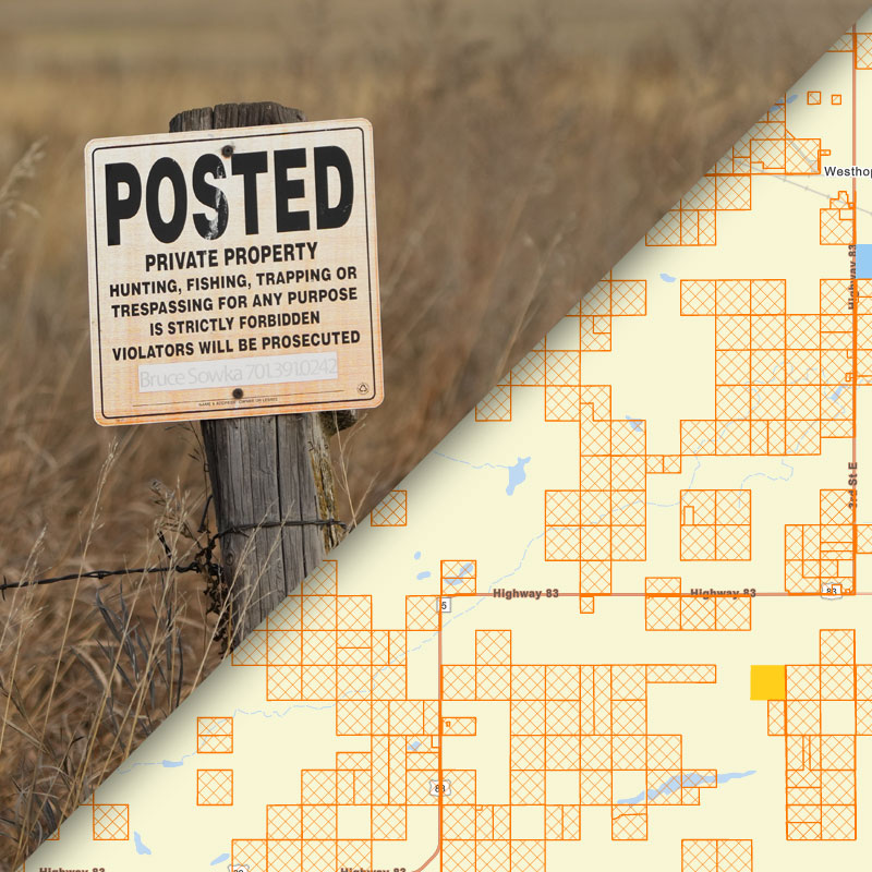
Note: If land is posted physically but not electronically, it will not be indicated on maps. In the field, hunters must determine if land has been physically or electronically posted prior to entering.
Hunting Private Lands
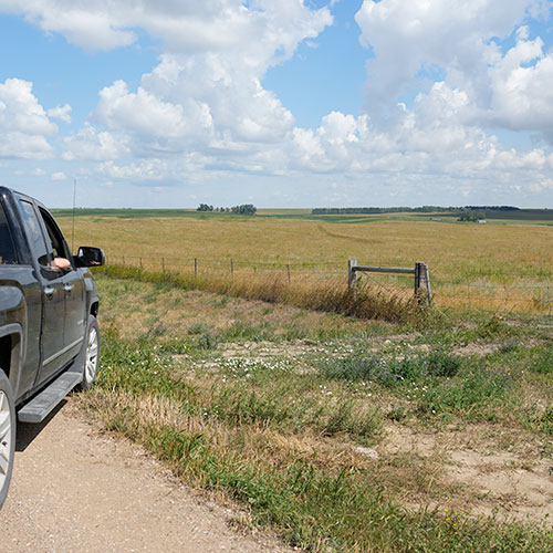
Private lands in North Dakota are open to hunting unless posted or otherwise restricted by law.
Posted vs. Open to Hunting
Posted
- Hunting is not allowed, without permission from the landowner or lessee, on private lands in North Dakota that have been legally posted physically or electronically.
Not Posted
- Private land that is not physically or electronically posted and is not otherwise restricted to hunting by law may be hunted without landowner permission.
- It is always best practice to speak with the landowner before hunting any private lands.
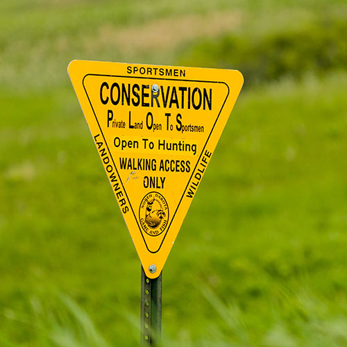
Private Land Open to Sportsmen
- PLOTS lands are private lands open to walk-in hunting only via agreements between the Department and the landowner.
- PLOTS lands are posted with PLOTS signs and can be found in the North Dakota Hunting Atlas.
- Note: Property enrolled in this program changes annually and is identified in the Department's maps.
Physical and Electronic Posting
Private land may be posted with physical signs, electronically or both.
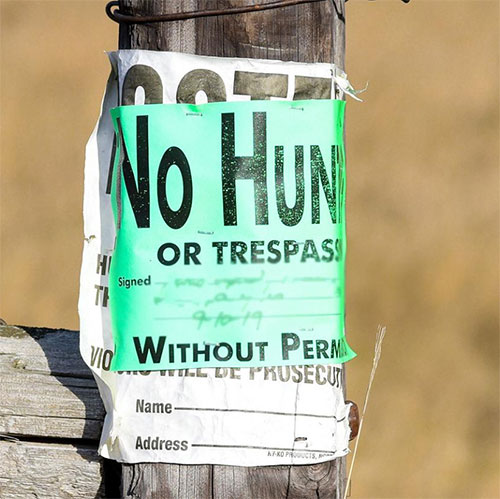
Physical Posting
- Physically posted land will have signs indicating that hunting is not allowed.
- If land is posted physically but not electronically, it will not be indicated on maps. Hunters must look for physical signage.
Electronic Posting
- Electronically posted lands will be indicated on the Department's hunting maps and services.
Contacting Landowners
While not all landowners are willing to entertain requests to hunt on their lands, many who are will provide contact information for hunters when enrolling their land in electronic posting.
If a landowner provided contact information, those contact details are available by clicking on their posted land in one of the electronic posting maps.
The Department also provides a hunter-landowner contact program to help licensed hunters and landowners connect.
Miscellaneous Private Lands Information
Penalty for Hunting on Posted Land - Hunters may not enter land legally posted (electronically or physically) without first obtaining permission of the person entitled to grant the permission. A person who violates NDCC 20.1.01-18 is guilty of a class B misdemeanor (up to $1,500/30 days imprisonment) for the first offense and a class A misdemeanor (up to $3,000/360 days imprisonment) for a subsequent offence within a two-year period. The court shall suspend the defendant's hunting, fishing and trapping privileges for a period of at least one year, two years for the second conviction and three years for the third or subsequent conviction.
Hunting Public Lands
Some public lands are open to hunting
North Dakota Game and Fish Department Managed Lands
Wildlife Management Areas
- WMAs are managed by the North Dakota Game and Fish Department and are located throughout the state.
- Unless otherwise specified, WMAs are open to hunting, fishing and trapping.
- Check the current hunting and fishing regulations.
- Note: Check signage at a WMA's entrance for regulations specific to that WMA.
Other Public Lands
The following agencies manage public lands, some of which are open for hunting. Hunting rules may vary, so check with the appropriate agency before hunting any of these public lands.