Avenza-Geospatial PDF App
The Avenza app is a free download and can be found in the:
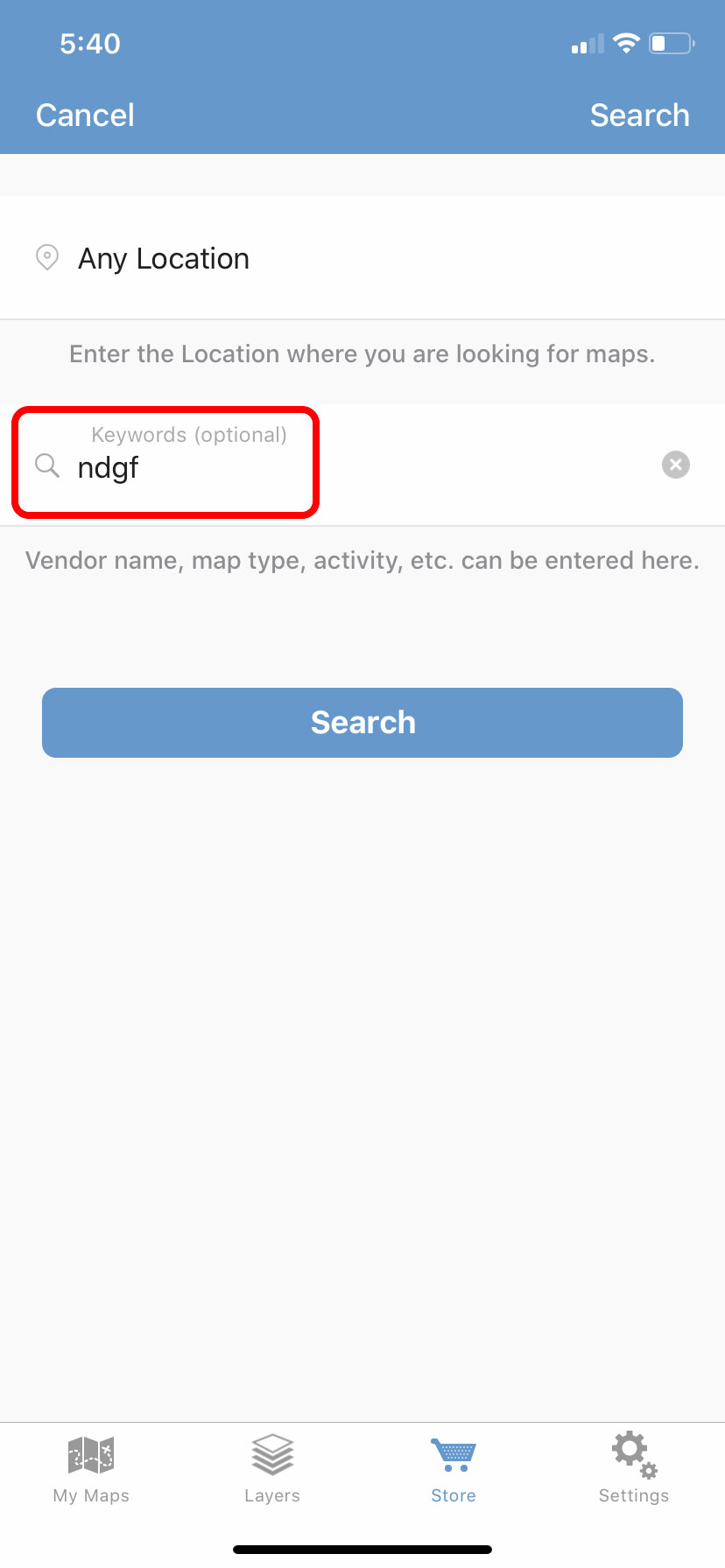
Note: Many of the Department's maps are available for free from the Avenza store as well. To find them search 'ndgf' while in the Avenza store.
Avenza-Geospatial PDF App
Geospatial PDF maps can be very useful when hunting, fishing or hiking in North Dakota where many areas do not have good cell reception. These maps can be downloaded and saved on a smartphone prior to going into the field. Once in the field, the phone’s GPS can be used to display the user’s current location on the map. No cell service is required since the map is already stored on the phone.
Using the Avenza Maps Mobile App
After installing the Avenza application, maps can be added in a few different ways. The example below shows how to load a map from a URL on an iPhone. This process will look somewhat different on an Android.
Load Map from URL Example (iPhone)
Step 1
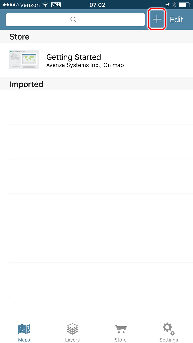
To add a map (limit 3 maps in free version), click on the + sign at the top of the app screen.
Step 2
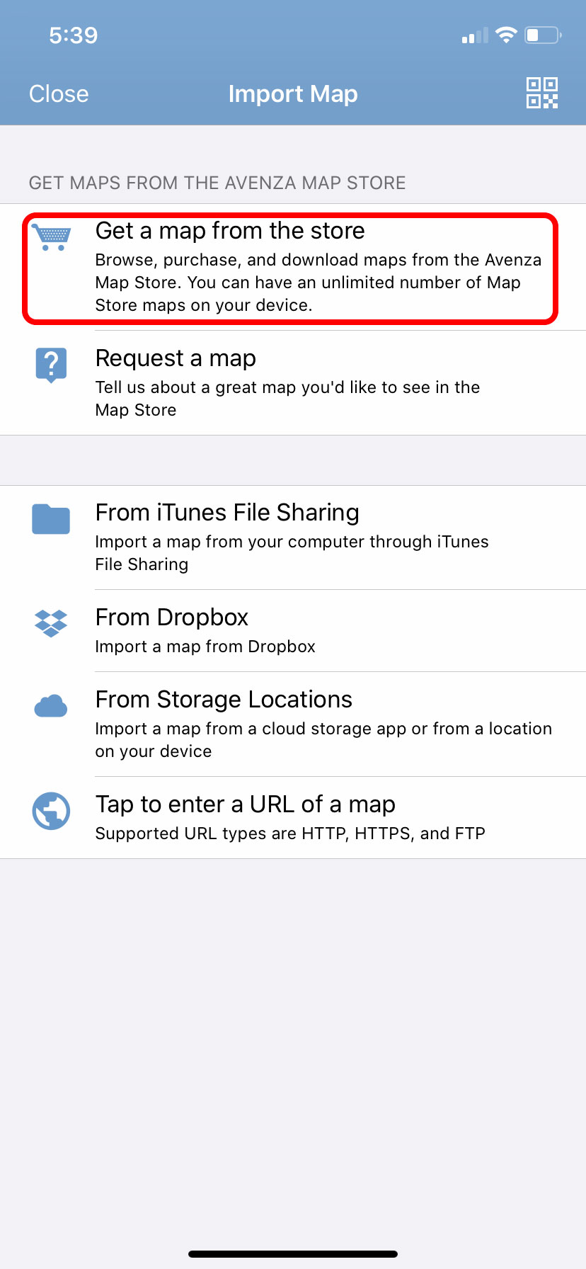
Choose Select "Get a map from the store".
Step 3
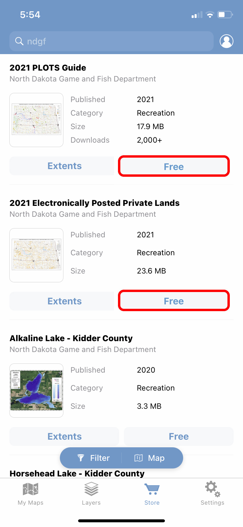
Enter "ndgf" then search.
Step 4
Click on "Free" then "Download".
Step 5
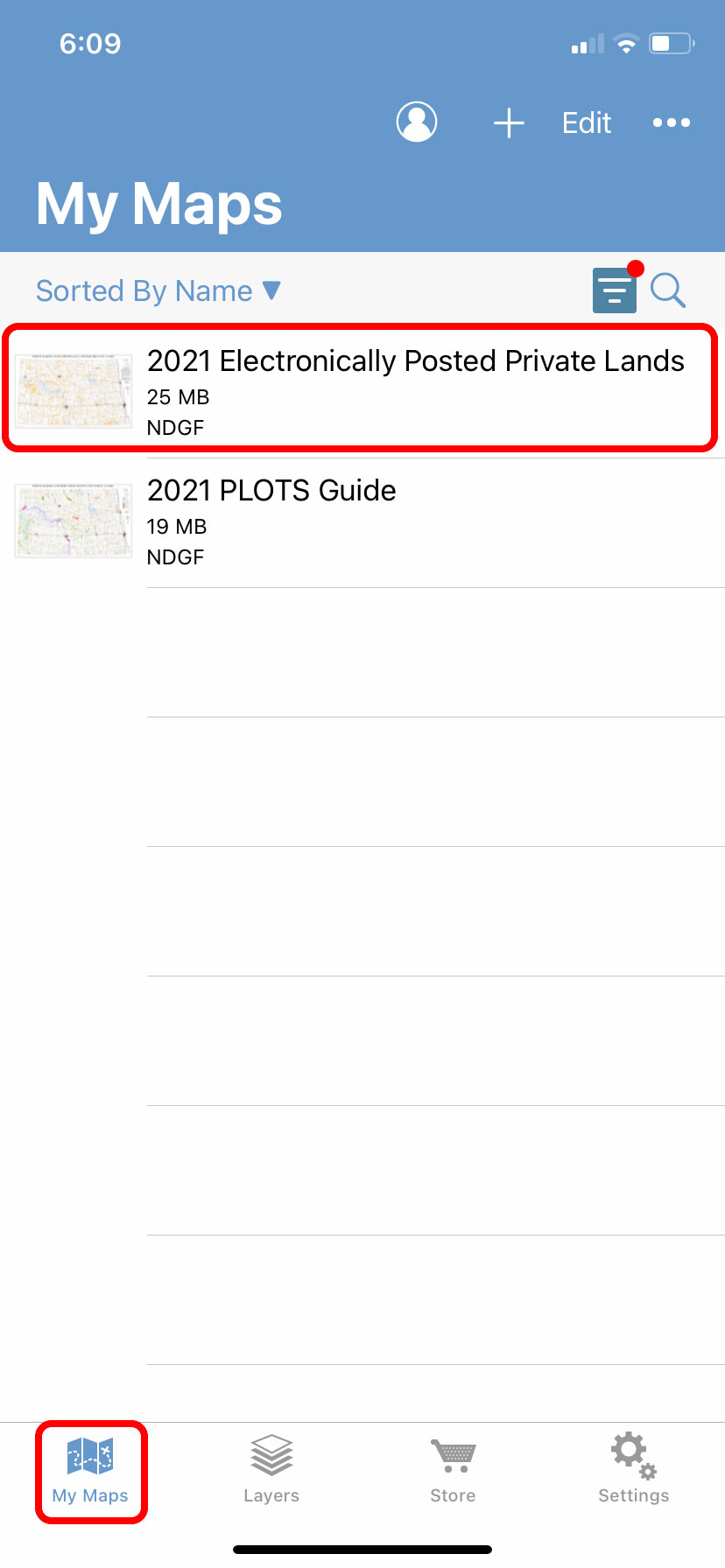
Go to "My Maps" and select the map to open.
Step 6
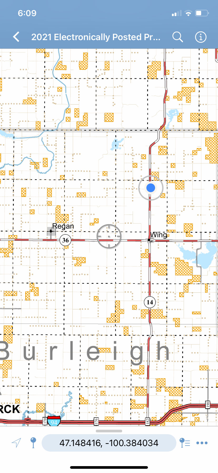
If you have your phone's location services turned on and you are within the map's boundries, a blue dot will show your location.
Step 7
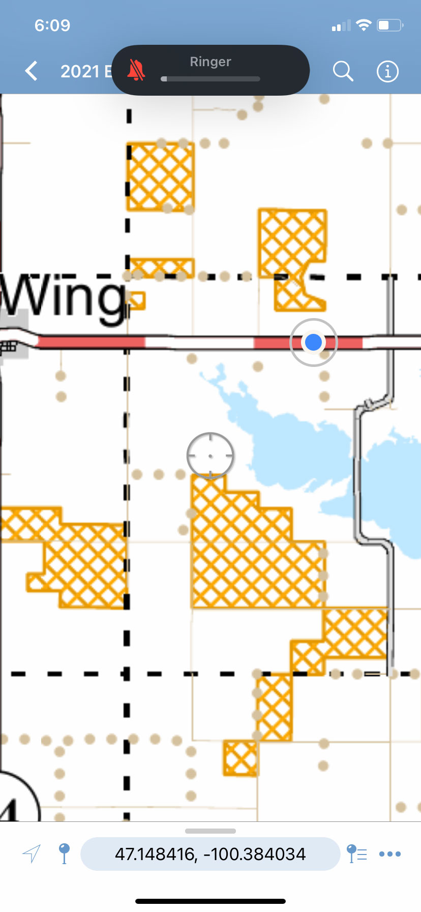
You can zoom in and out.
Step 8
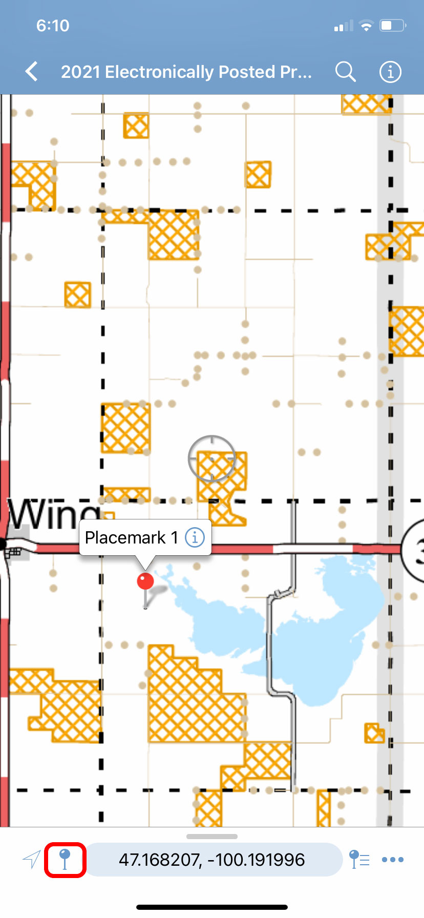
Use the pin icon to drop a pin/bookmark onto the map.
