
Focus on Grasslands in a Prairie State
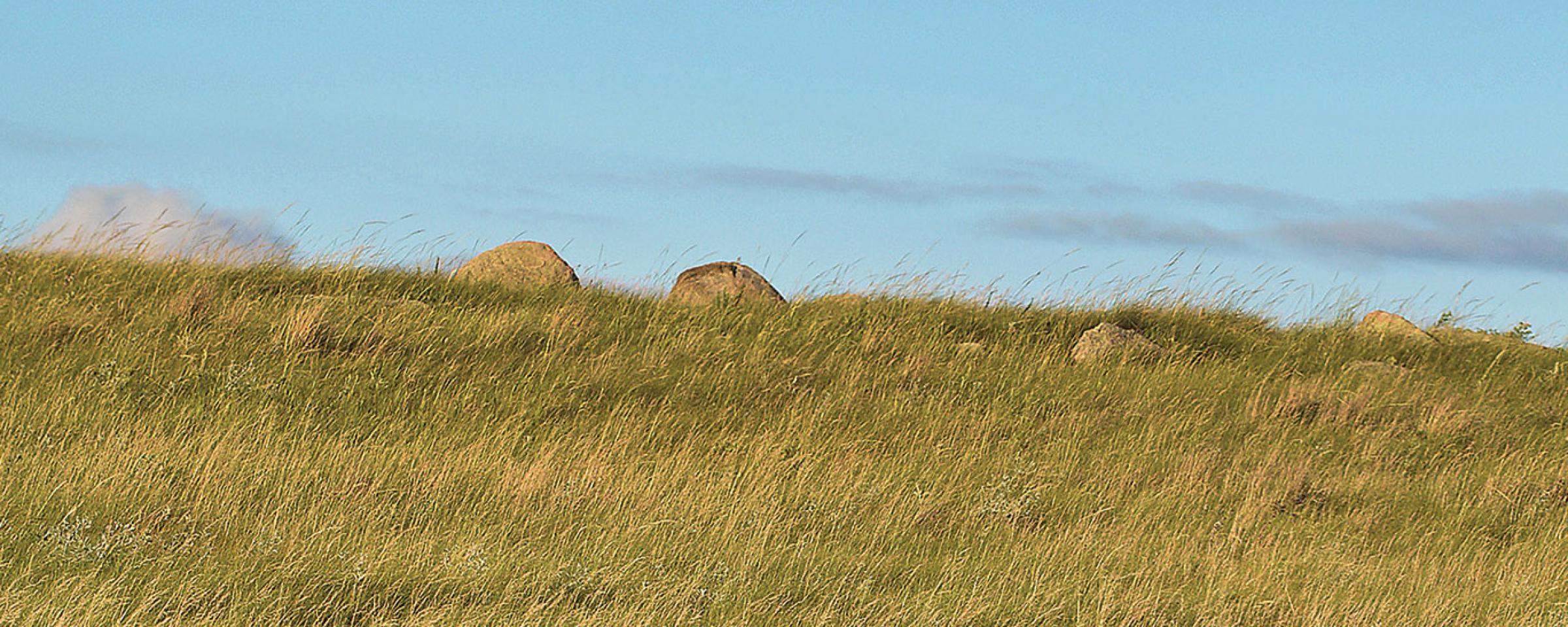
Not every grassland is a prairie, but a prairie is most certainly a grassland, as are pastures, rangelands, hayland and any other large expanse of mostly treeless landscape covered in green. People sometimes see grasslands as empty or unexciting, and it often takes a closer inspection to appreciate all the birds, mammals and insects that depend on grassland for their existence. This special section is a start of that "closer inspection," focusing on the values and importance of North Dakota"s prairies and other grasslands.
North Dakota Grassland History
Prior to settlement in the late 1800s, North Dakota was described as "great uninterrupted expanses of nearly treeless prairie … the only extensive tracts of forest were restricted to floodplains and east- or north-facing bluffs along rivers and large creeks to certain prominent hills or escarpments ... and hundreds of thousands of shallow ponds and lakes in the glaciated regions." (Stewart, 1976).
The landscape described by many early explorers and pioneers has changed considerably, and North Dakota is not the vast expanse of treeless prairie it once was. It is estimated that more than 50 percent of North Dakota"s original prairie and wetlands have been converted to cropland, urban areas, roads and other infrastructure.
As such, many wildlife and insect species that depend on North Dakota grass as part of their life cycle are not as numerous as they once were.
Some of these species, like the LeConte"s sparrow and Poweshiek skipperling butterfly, are little known outside of the scientific community. However, iconic species like North Dakota"s state bird the Western meadowlark, and the familiar monarch butterfly, are also getting considerable attention.
In late 2015 North Dakota Game and Fish Department biologists completed an updated State Wildlife Action Plan, a document that details the status of more than 100 species of birds, mammals, fish and insects that are considered "Species of Conservation Priority." What that means in general is species that research indicates have declined in population or range in the past decade, or species that probably need further study to document their population level.
The species in question depend on a variety of different habitats, like rivers, lakes, forests and badlands, but more than half of the 115 species on the 2015 list of North Dakota Species of Conservation Priority depend on native prairie or other grasslands.
While that"s a significant part of the list, North Dakota does have many large tracts of native prairie and other grasslands that still exist, and there is great potential to protect, conserve or enhance what remains.
Not all Grassland is the Same
Native prairie is generally divided into three main categories; tallgrass, mixed-grass, and shortgrass. Each prairie community is comprised of a unique blend of grasses and forbs. North Dakota has all three grassland types, which are generally differentiated by region of the state.
The following descriptions of North Dakota"s prairie regions is excerpted from the 2015 North Dakota State Wildlife Action Plan.
Tallgrass Prairie (Red River Valley)
Area: 4,464,000 acres or 6,975 square miles
Tallgrass prairie once covered much of the central United States and Canada and occupied roughly the eastern one-fourth of North Dakota. It is estimated only 3 percent of it remains unplowed, and North Dakota"s remaining tallgrass prairie is found almost exclusively in the Red River Valley.
Tallgrass prairie developed over much of the exposed lakebed of glacial Lake Agassiz. The flat topography and rich soil of the Lake Agassiz basin provided an ideal growing environment for prairie plants and is now doing the same thing for agricultural crops including potatoes, beans, sugar beets, corn and wheat. It"s also worth noting that the tallgrass prairie region on average receives several more inches of precipitation per year than the shortgrass prairie region in western North Dakota.
By the 20th century, within only 20 years after the first wave of homesteaders moved into eastern North Dakota, much of the tallgrass prairie was already converted to farmland. Few tracts of native vegetation remain in this region today.
The largest continuous area of remaining tallgrass is just west of Grand Forks and is sometimes referred to as the Grand Forks County Prairie.
Tallgrass prairie can include more than 200 plant species. The most common and dominant of these are big bluestem, switchgrass, Indiangrass and prairie dropseed.
Eastern Mixed Grass Prairie (Drift Prairie)
Area: 16,900,000 acres or 26,400 square miles
Eastern mixed-grass prairie, or Drift Prairie, is the transition zone between the wetter environment where tallgrass prairie grows to the east, and the drier shortgrass prairie region to the west.
Approximately 1.4 million acres of wetland basins are present throughout this region, though many were drained, filled or consolidated.
A large area of untilled land, due to its sandy, gravelly soil from a glacial lake delta, exists in and around McHenry County and south of the Turtle Mountains. This focus area, referred to as "Glacial Lake Deltas" is to a large extent native vegetation with many wetlands remaining.
The Souris River riparian area divides the Glacial Lake Deltas. Another focus area, the "Devils Lake Basin," is the result of glacial ice blockage and includes a high concentration of larger wetlands or lakes and less grassland than the Glacial Lake Deltas. This focus area is extremely important for migrating waterfowl and other waterbirds and shorebirds.
The remainder of the Drift Prairie is generally flat land, much of which is now cropland.
The Drift Prairie is dominated by warm and cool season grasses as well as sedges. Common grass species include prairie junegrass, Western wheatgrass, green needlegrass, needle-and-thread, blue grama, little bluestem and needleleaf sedge.
Mixed-grass Prairie (Missouri Coteau)
Area: 10,215,000 acres or 15,960 square miles
This landscape component includes the mixed-grass prairie of the Missouri Coteau and associated wetlands. Combined with the Drift Prairie, most of North Dakota is dominated by mixed-grass prairie.
This region marks the boundary of the western limits of glaciation in North Dakota. The hummocky, rolling hills of the Missouri Coteau dramatically rise 150 to 500 feet above the Drift Prairie. A high concentration of wetlands are present, roughly 800,000 basin acres. A considerable amount of native prairie remains and there is extensive cattle grazing.
The Coteau is known for supporting some of the highest numbers of breeding ducks in North America. Due to the large amount of grassland and wetlands which remain or have been restored, this area is especially crucial to many species of grassland wildlife and constitutes the focus area "Missouri Coteau Breaks."
Western Mixed-grass / Shortgrass Prairie (Missouri Slope)
Area: 10,768,000 acres or 16,825 square miles
This landscape component includes the western mixed-grass and shortgrass prairie of the Missouri Slope. This semiarid, unglaciated region of North Dakota includes level to rolling plains with isolated sandstone buttes or badlands formations. Natural wetland basins are minimal, but small creeks and streams are abundant.
Shrub-steppe, or prairie that has a large component of sagebrush, occurs scattered throughout. Land use is predominantly dryland farming of spring and winter wheat, barley, sunflowers and corn, interspersed with cattle grazing. Landcover classifications indicate there is a considerable amount of native vegetation remaining.
Shortgrass prairie grass species mature at 6-12 inches in height and include spikemoss, blue grama, needleleaf sedge, threadleaf sedge, buffalo grass, and needle-and-thread.
Planted or Tame Grassland
Area: Statewide, estimate 2-5 million acres
This landscape component includes land that at one time was converted to cropland and then was replanted to hayland, tame or native grasses. Approximately 5 percent of North Dakota is considered as hayland, and planted alfalfa is the most common hay crop.
The U.S. Department of Agriculture"s Conservation Reserve Program was established in the 1985 Farm Bill as a way for producers to reduce soil erosion by retiring marginal cropland from production for 10-15 years. The CRP also provides stable income for producers and delivers unprecedented wildlife habitat and conservation of soil and water. Larger tracts of CRP, particularly those near other existing native or planted grassland, are more attractive and more productive than smaller tracts of CRP.
These larger tracts, in concert with surrounding landscape features, are a focus area of this landscape component. CRP is generally left idle, although managed and emergency haying and grazing of CRP is periodically allowed. Producers can hay or graze CRP once every three years, keeping outside of the primary nesting season defined as April 15-August 1.
More than half of the CRP contracts in North Dakota have expired since 2007 and new contracts have been limited because of a lower national acreage cap and other factors. The loss of CRP on the North Dakota landscape is detrimental to wildlife populations.
Tame grasslands are widespread throughout the state on wildlife management areas, waterfowl production areas and other publicly owned land.
Conservation Actions
The SWAP provides detailed descriptions of threats and conservation actions for each of the major landscape components, as well as species management recommendations. The focus is on solutions to preventing species from becoming federally threatened or endangered.
Five recurrent conservation actions identified throughout all major landscape components are designed to make this happen.
- Offer incentives and programs to protect, enhance and restore habitat. The majority of land in North Dakota is held in private ownership. Numerous federal, state and local programs are available to provide landowners with cost-sharing assistance to protect, enhance and restore wildlife habitat. This is the primary mechanism for ensuring long-term conservation of Species of Conservation Priority and other wildlife in North Dakota. North Dakota Game and Fish staff will work with partners to ensure programs fully encompass the needs to conserve Species of Conservation Priority and expand programs where necessary, particularly Farm Bill programs, such as the Agricultural Conservation Easement Program, and pollinator habitat programs.
- Urge ecologically responsible ordinances and suitable reclamation standards. Increasing demand for urban, energy and utility development is heightening the need to minimize impacts to Species of Conservation Priority and other wildlife. Although environmental review is provided by federal and state agencies, ecologically sound ordinances and reclamation standards are needed.
- Promote and support holistic grazing and work with grass-based agricultural groups. The majority of the Species of Conservation Priority depend on grassland. The key to maintaining grassland as an integral part of the North Dakota landscape is to ensure grassland ranching persists. Prairies evolved with grazing by large ungulates and cattle grazing is a beneficial tool to maintain native vegetation, particularly if applied in a holistic manner.
- Use best management practices or ecological site descriptions. Experts in various fields have developed best management practices for a particular habitat component. These valuable tools should be employed when restoring or managing native communities.
- Public education and outreach. The key to successful implementation of wildlife conservation for public use and enjoyment depends upon awareness, understanding and appreciation of these resources.
What is North Dakota"s State Wildlife Action Plan?
The 2015 North Dakota State Wildlife Action Plan replaces the 2005 North Dakota Comprehensive Wildlife Conservation Strategy as the principle document for safeguarding rare and declining fish and wildlife species in North Dakota.
This newer "second edition" not only has a different name, but has been revised to include new information generated by State Wildlife Grant studies conducted over the past 10 years.
Examples include, but are not limited to, changes to the species of conservation priority list, focus areas, range/distribution maps, threats and management actions.
The SWAP is built upon eight essential elements, with an overall focus on the "species of greatest conservation need," or as we have labeled them, "Species of Conservation Priority."
The number of Species of Conservation Priority increased from 100 under the old plan to 115 in the current SWAP. While 20 new species were added to the list, five species were removed.
The current list includes 47 birds, two amphibians, nine reptiles, 21 mammals, 22 fish, 10 freshwater mussels and four insects.
Completion of the SWAP marks the 10-year anniversary of the first dedicated program for rare and declining fish and wildlife species in North Dakota. Although substantial progress was made in the past decade, considerable work remains.
As North Dakota is experiencing widespread habitat threats and challenges, the SWAP will serve as an important tool in dealing with these issues.
Furthermore, preventing species from becoming listed as federally threatened or endangered is important. A listing has the potential to influence how public and private land is managed and used. The cost of protection or restoration of a listed species is far greater than preventing its decline in the first place.
Where to find more information
The North Dakota State Wildlife Action Plan, a list of Species of Conservation Priority and information on State Wildlife Grants can be found on the State Wildlife Action Plan webpage.
Contact the SWAP Authors:
Steve Dyke, Conservation Supervisor, 701-328-6347
Sandra Johnson, Conservation Biologist, 701-328-6382
Patrick Isakson, Conservation Biologist, 701-328-6338