Ramsey. Richland. Slope.
Three counties that could possibly shape the future of hunting in North Dakota.
As part of a pilot study authorized by the 2019 state legislature, Ramsey, Richland and Slope were chosen to test a system that allows landowners the option to electronically post their land through an online application that is linked to land descriptions based on property tax records.
Current state law provides that private land is open to hunting unless the landowner, or an individual authorized by the owner, posts the land with signs notifying hunters that no hunting is permitted unless permission is obtained.
“This allows landowners in those three counties an additional option, to try a new concept by using technology for managing access this fall,” said Terry Steinwand, North Dakota Game and Fish Department director.

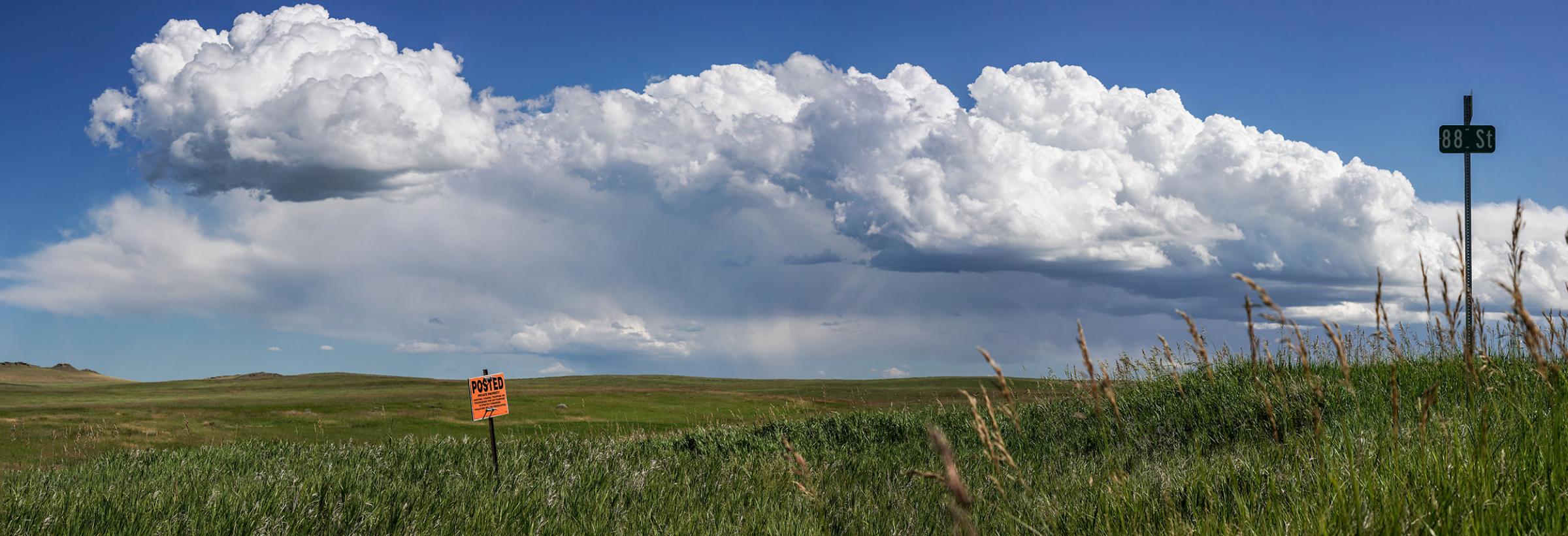
While mule deer can be found elsewhere in the state, most people think of the western part of the state when it comes to mule deer. Slope County, one of three counties in the pilot study, is located in southwestern North Dakota where a fair share of the state’s mule deer population can be found.
But first, let’s back up. How did we get here?
Automatic posting has been an issue in North Dakota’s state legislature for a minimum of the last 16 years. Bills were introduced in different variations, and all were defeated largely due to concerns from both hunters and landowners who were opposed to the concept.
Initially, landowners expressed concerns over the time and expense to place physical signs on private property, but during the 2019 session, private property rights were added, and legislation was drafted that would have overturned current law and made all private land closed to hunting without permission. The bill was modified in the Senate to include electronic posting, but some amendments were made in conference and the bill was defeated in the House of Representatives.
Subsequent legislation then created the study to determine if there was a way to relieve landowners of the burden of putting up signs every half-mile around their property.
“Study access to public and private lands for hunting, trapping, fishing and related issues, including trespass violations and penalties, and provided recommendations regarding a land access database and the capability of electronic posting. At the direction of the Legislative Management, before August 1, 2020, the Information Technology Department and Game and Fish Department shall establish a trial electronic posting and hunter access information system in up to three counties. The Information Technology Department and Game and Fish Department may contract with a third party to assist with the electronic posting and hunter access information system development and operation.”
“Richland, Ramsey and Slope counties volunteered for the study, were chosen by the interim committee and represent counties with GIS land parcel capabilities,” Steinwand said. “And, all three counties are rich in hunting activity.”
Sen. Robert Erbele, chairman of the Interim Natural Resources Committee tasked with undertaking the study, said since this is a trial study, landowners who volunteered to participate in electronic posting must still physically sign those land parcels.
“There aren’t any penalties in law that address electronic posting, therefore the landowner still has to physically post the land for this year,” Sen. Erbele said. “Our intention is that hunters will view the application and they will see the posted tract, honor it and will not have to go out and look for a posted sign.”
Altogether, 79 landowners in the three counties met the July 15 deadline to electronically post their land, totaling 268 parcels and 38,600 acres.
What does this mean for hunters this fall?

Current state law provides that private land is open to hunting unless the landowner, or an individual authorized by the owner, posts the land with signs notifying hunters that no hunting is permitted unless permission is obtained.
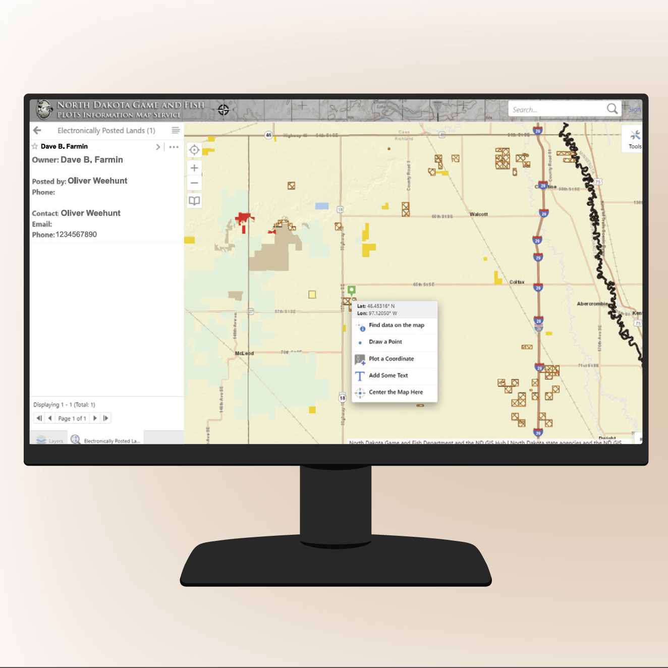
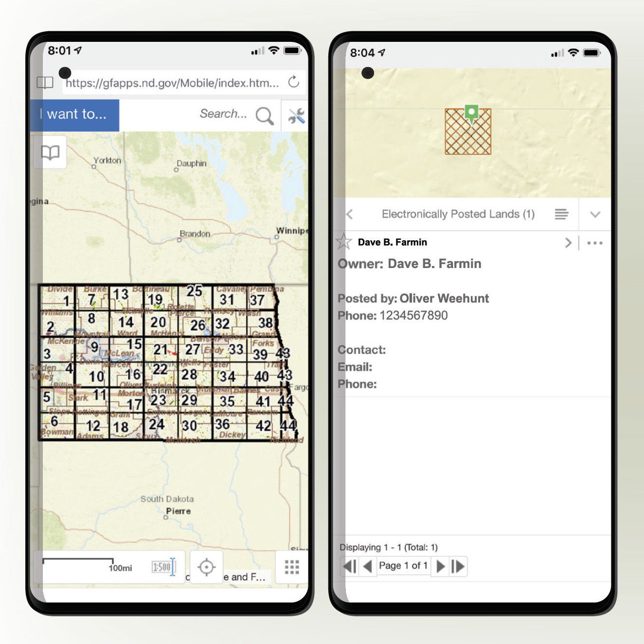
Hunters interested in viewing maps displaying electronically posted lands should visit the Electronic Posting Pilot Study page. Private land that is posted electronically is viewable on a personal computer or smartphone. Hunters can use any of the map resources presented on the website. These map resources will temporarily include electronically posted lands during the 2020-21 hunting season. In addition, individual map pages that are seen on the guide viewer can be printed.
“Under this section of the website, you'll see a portion for map resources and the tools that can be used, whether it is printing maps and taking them in the field with you, or making use of some of the technologies with a smartphone or a mobile device of some kind, you can access the other applications that are available,” said Brian Hosek, with Game and Fish administrative services. “Each of these applications have their strengths and weaknesses, so some you access through a browser and you navigate to the website to launch the application to use it. They do have a rich set of tools with them where you can identify features and see the contact information for the landowner who posted the land.
“You can also create your own maps. Others are native mobile applications, so that's something that you go out to one of the stores to download to your device,” he added. “With these applications some of them you need internet access, so you need cell service range. There is another application that doesn't require cell service, so it does require you to upload the maps before you go out in the field, but you can certainly do so prior and then you have this out in the field with you if you're out of cell service range.”
A benefit of electronic posting, Hosek said, is the ability for hunters to determine a point of contact for the landowner, or authorized individual who posted the land.
“The point of contact, including a phone number and email in some cases, is included on the map service application,” he said.
Steinwand reminds hunters to be respectful of landowners and be mindful of their daily schedules, as farmers will be busy with fall duties, including harvesting crops, moving cattle and hauling bales.
Hunters and landowners using the electronic posting application will receive a brief survey, asking to provide their experience using the map and electronic posting applications. The information collected will help the Interim Natural Resources Committee determine the usability of the electronic posting application and provide direction for changes required to existing law. The committee is comprised of legislators, and representation from landowners and sportsmen’s organizations.
“We need hunters to use this map application and take the little time necessary to complete the survey,” Steinwand said. “The more information that is gathered will help guide the committee moving forward.”
If the current law eventually becomes amended to include electronic posting, Sen. Erbele believes the penalties for violating electronic posting should be the same as the current penalties for hunting on physically posted land.
In addition, if lawmakers deem that the pilot study provides a viable solution and is amended into current law, Hosek said it’s possible for counties to be on board in short order.
To access PLOTS interactive guide via desktop computer:
- Go to gf.nd.gov
- Under Season Shortcuts, click “Electronic Posting Pilot
- Study”
- Click on PLOTS Guide Viewer under Map Resources
- Scroll, click and drag to zoom/pan around map
- Locate an electronically posted area, denoted by
- crosshatching
- Right-click area and choose “Find data on the map” or
- use identifying tool
- Repeat steps 6-7 for other electronically posted areas
To access PLOTS interactive guide via mobile phone (with cellular service)
- Go to gf.nd.gov
- On the homepage, tap the compass icon
- Locate and tap Map Service Apps
- Scroll to bottom, tap PLOTS Guide Viewer
- Pinch to zoom and tap to drag around the map
- Locate an electronically posted area, denoted by
- crosshatching
- Tap and hold, then choose “Find data on the map” or
- use identifying tool
- Repeat steps 6-7 for other electronically posted areas