

Web and Data Services
North Dakota Geographic Information Systems
(Note: For redistribution of North Dakota Game and Fish Department data, please contact the Department at 701-328-6369.)
The North Dakota GIS Website contains state geospatial data and information. The contents of this site are managed by the North Dakota GIS Technical Committee.
The GIS Website is built on an open data platform that provides functionality beyond traditional means of retrieving data. This is a tool for finding downloadable GIS data, GIS web services, and GIS applications using geographic extents, searching by keywords, browsing or searching within categories, or some combination of all.
Web Services: Esri REST (Representational State Transfer) Services
The North Dakota Game and Fish Department provides a simple web interface solution to access the Department's published GIS web services using the ArcGIS Server REST (Representational State Transfer) API. These web services provide the means of streaming GIS data to the computer, avoiding the need to download. These services may provide a better solution when accessing dynamic data, providing the user with the most current information available.
For additional information on access and/or use of Esri web services, visit Accessing Web Services from the North Dakota GIS website.
- North Dakota GIS Hub
- North Dakota Game and Fish Department General Information
- North Dakota Game and Fish Department PLOTS Guide
- North Dakota Game and Fish Department Fishing Waters
- North Dakota Game and Fish Department Lake Contours
- North Dakota Game and Fish Department Species Range and Habitats
Data Services
These applications include common state data resources for searching, viewing and downloading available data.
ND HUB Data Portal
Find data, web services, maps and applications
Aerial Imagery Dissemination
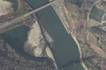
Provides access to a variety of North Dakota aerial imagery and photography.
LiDAR Dissemination
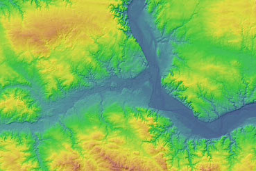
Provides access to a variety of North Dakota Light Detection and Ranging elevation data.