
2025-26 Waterfowl Rest Area Proclamation
2025 Waterfowl Rest Area Proclamation
NOTE: The following is a copy of the text from the 22025 Waterfowl Rest Area Proclamation.
A scanned copy of the signed proclamation is also available (pdf).
Pursuant to law and the recommendation of the Game and Fish Director, I hereby declare certain areas as Waterfowl Rest Areas from September 27, 2025 through December 31, 2025. All Waterfowl Rest Areas listed below shall be closed to waterfowl hunting and fishing during this period, except as hereinafter specified below. Waterfowl Rest Areas, if open to public access, are open for ice fishing before December 31st if ice conditions are suitable.
Waterfowl Rest Areas
Mclean, Mercer and Oliver Counties:
(1) Missouri River - An area enclosed by the following boundaries: Starting at the east bank of the Missouri River at the mouth of Turtle Creek south of Washburn, thence north along the east bank of the Missouri River to Garrison Dam, thence west along the face of the dam to the west bank of the Missouri River, thence south along the west bank of the Missouri River to a point directly west of the mouth of Turtle Creek, and thence east to the point of origin. Closed to goose hunting only.
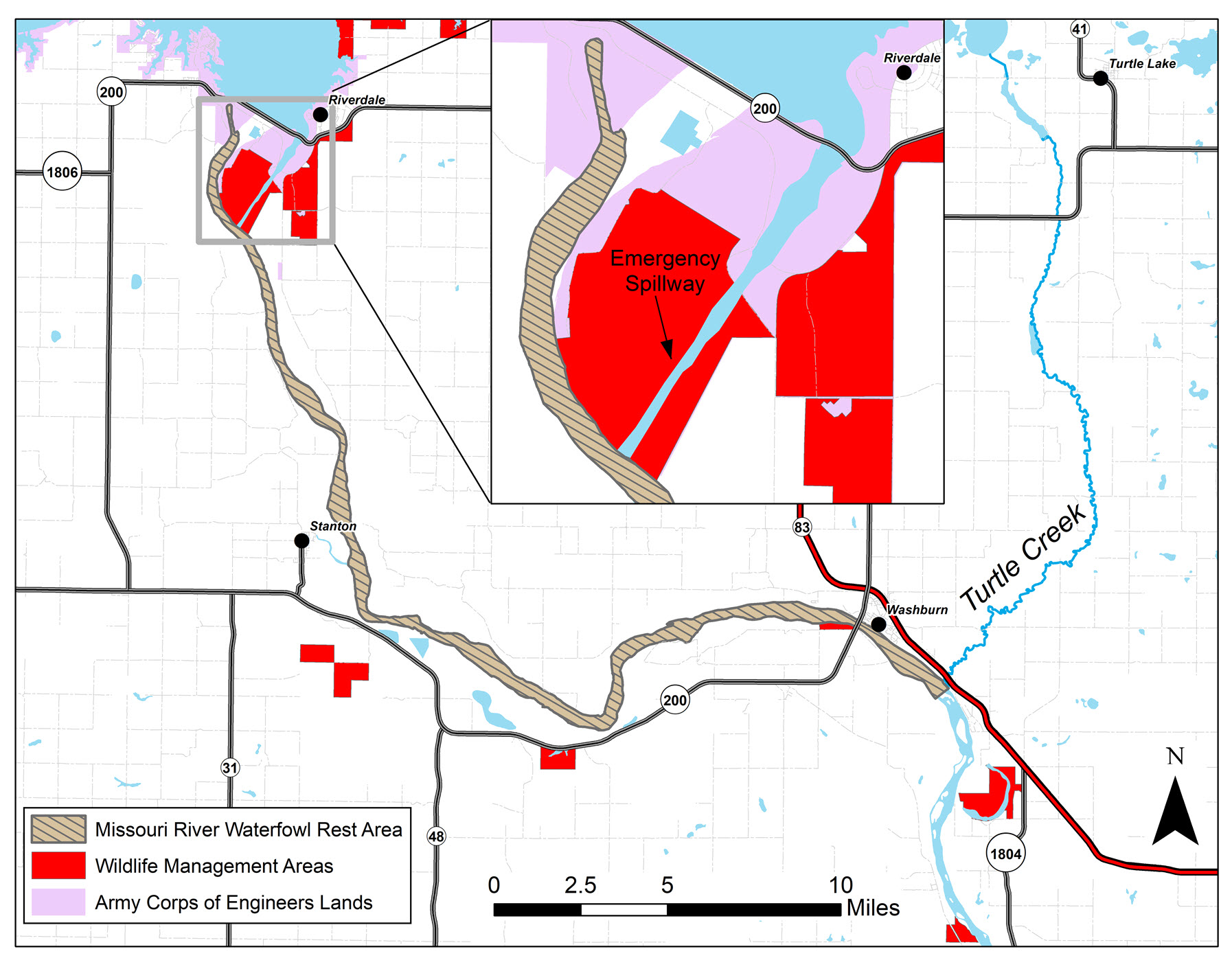
Figure 1: Map of the Missouri River Waterfowl Rest Area and associated public lands.
Sheridan County:
(1) The meandered portion of Sheyenne Lake in Section 23, Section 24, Section 25, and Section 26, Township 149, Range 75; and in Section 29, Section 30, Section 31, and Section 32, Township 149, Range 74.
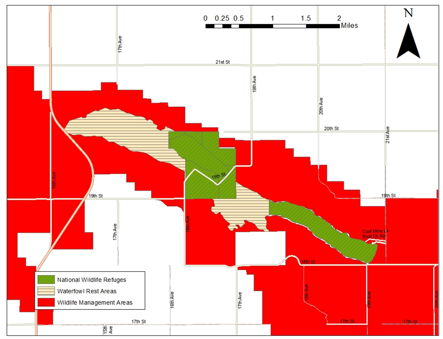
Figure 2: Map of the Sheyenne Lake Waterfowl Rest Area, with associated public lands and PLSS Section grid lines.