Using the Conservation PLOTS Guide
The Conservation PLOTS Guide is made up of 44 detailed map sheets. On the back cover of this guide is an index to the detailed map sheets. To use this guide, locate the general area in the state on the index and then turn to the corresponding map sheet on the inside of the guide; each map sheet is numbered on the top and bottom of each sheet, as well as the index. The detailed maps show PLOTS and other public trust lands such as WMAs, WPAs, state school lands, national wildlife refuges, national grasslands and many more.
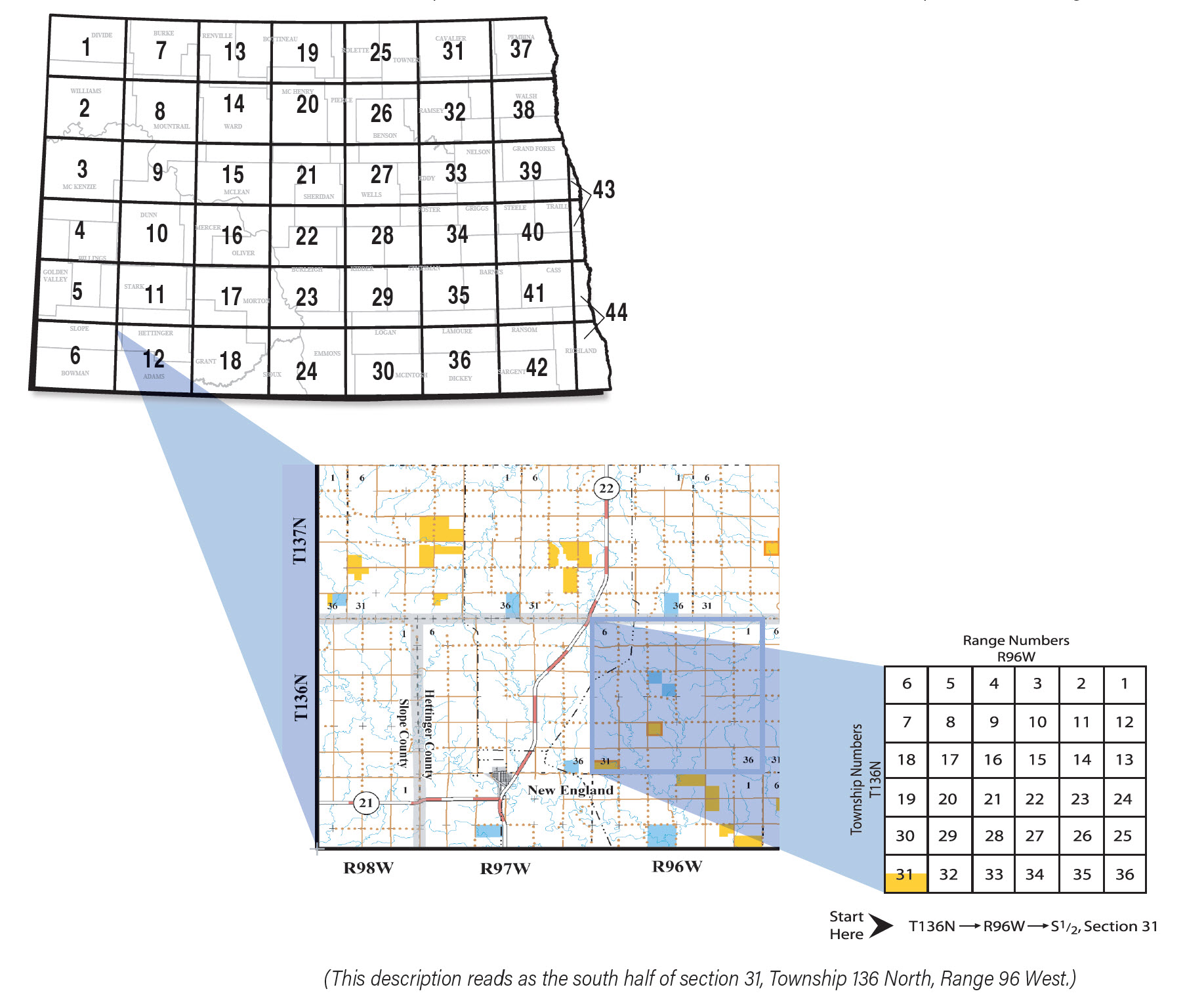
Understanding Legal Descriptions
Legal descriptions are based on a system that uses a grid with two sides, township and range. An individual township is a square tract of land with sides of 6 miles each, and containing 36 sections of land, each section is 1 mile square and contains 640 acres.
Every legal description has a township, range and section. To determine where a tract of land is located on a map sheet, first find the township number located on the right or left side of the map. Then find the range number located on the top or bottom of the map.
Next, find the point where the township number and range numbers intersect on the map; this should be in the center of the township and will contain 36 square sections. Now locate the section number within the township.
The location of the tract of land is described in such terms as N½ (north one-half), SE¼ (south east one-fourth or quarter), etc. Legal descriptions always read first from either the north or the south, such as NE (northeast) or SW (southwest), etc. They are never WN (westnorth) or ES (eastsouth), etc. The example below reads as the south half of section 31, Township 136 North, Range 96 West.
Click to enlarge