
PLOTS Maps Legend
How to Use PLOTS Maps | PLOTS Map Index
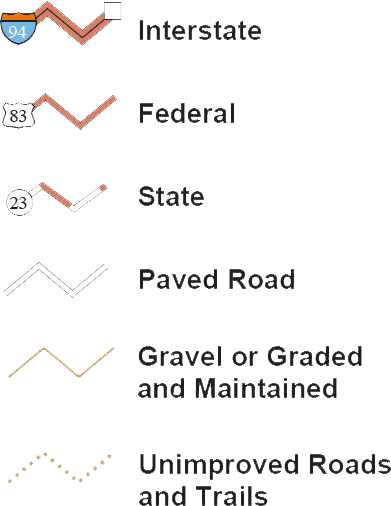
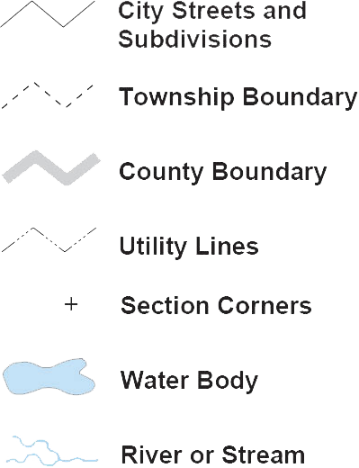
Roads, Boundaries, Waters
Lands
North Dakota Game and Fish Private Land Open To Sportsmen
![]()
Marks the boundary of Private Land Open To Sportsmen for walk-in hunting opportunities. Nontoxic shot is not required for upland game.
North Dakota Game and Fish Wildlife Management Areas
![]()
Marks the boundary of lands open to hunting and fishing in accordance with state regulations. Nontoxic shot is not required for upland game.
Private Land
Electronically Posted
![]()
Marks the boundary of private lands electronically posted "closed to hunting". Requires landowner permission.
North Dakota Department of Trust Lands School Trust Lands
![]()
Marks the boundary of lands open to walk-in hunting unless otherwise posted with official Department of Trust Lands signs. Nontoxic shot is not required for upland game.
North Dakota State Forest Service
![]()
Marks the boundary of lands open to walk-in hunting unless otherwise posted with official State Forest Service signs. Nontoxic shot is not required for upland game.
U.S. Fish and Wildlife Service National Wildlife Refuges
![]()
Marks the boundary of national wildlife refuges. Consult refuge manager for specific regulations.
U.S. Fish and Wildlife Service Waterfowl Production Areas
![]()
Marks the boundary of lands open to hunting and fishing in accordance with state regulations. Nontoxic shot is required when hunting on these areas.
U.S. Forest Service National Grassland
![]()
Marks the boundary of lands open to hunting and fishing in accordance with state regulations. Nontoxic shot is not required for upland game.
U.S. Forest Service National Grasslands Nonmotorized
![]()
Marks the boundary of nonmotorized, semi-primitive recreation lands open to hunting and fishing in accordance with state regulations. Nontoxic shot is not required for upland game.
U.S. Army Corps of Engineers
![]()
Marks the boundary of lands open to walk-in hunting unless otherwise posted as closed. Nontoxic shot is not required for upland game.
U.S. Bureau of Reclamation
![]()
Marks the boundary of lands open to hunting and fishing in accordance with state regulations. Nontoxic shot is not required for upland game.
U.S. Bureau of Land Management
![]()
Marks the boundary of lands open to hunting and fishing in accordance with state regulations. Nontoxic shot is not required for upland game.
Waterfowl Rest Areas
![]()
Consult waterfowl proclamation for specific regulations.
Ducks Unlimited
![]()
Marks the boundary of Ducks Unlimited property open for walk-in hunting opportunities. Nontoxic shot is not required for upland game.
The North Dakota Game and Fish Department compiled these maps according to conventional cartographic standards, using the most reliable information available. The Department does not guarantee freedom from errors or inaccuracies and disclaims any legal responsibility or liability for interpretations made from these maps, or decisions based thereon. The colors of land features may look slightly different when covered by water.